| Stauning Alps | |
|---|---|
| Stauning Alper | |
 One of the massive ranges at the southern end of the Stauning Alps viewed from the Nordvestfjord | |
| Highest point | |
| Peak | Dansketinden |
| Elevation | 2,842 m (9,324 ft) |
| Dimensions | |
| Length | 120 km (75 mi) N/S |
| Width | 50 km (31 mi) E/W |
| Area | 6,000 km2 (2,300 sq mi) |
| Geography | |
| Country | Greenland |
| Range coordinates | 72°0′N 25°0′W / 72.000°N 25.000°W |
| Geology | |
| Rock type | Metamorphic rock[1] |
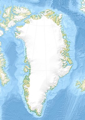
The Stauning Alps (Danish: Stauning Alper)[2] are a large system of mountain ranges in Scoresby Land, King Christian X Land, northeastern Greenland. Administratively the Stauning Alps are part of the Northeast Greenland National Park zone.
This mountainous area was named after Danish politician Thorvald Stauning (1873–1942) who had helped to finance expeditions to east Greenland planned and carried out by Danish explorers.[3]
- ^ Haller, J. 1958: Der ‘Zentrale Metamorphe Komplex’ von NE-Grönland. Part 2. Die geologische Karte der Staunings Alper und des Forsblads Fjordes. Meddelelser om Grønland 154(3), 153 pp.
- ^ "Stauning Alper". Mapcarta. Retrieved 18 June 2016.
- ^ "Catalogue of place names in northern East Greenland" (PDF). Geological Survey of Denmark. Retrieved 30 December 2016.
