Stonehaven
| |
|---|---|
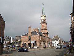
 Market Square, Stonehaven | |
Location within Aberdeenshire | |
| Population | 11,150 (2022)[1] |
| OS grid reference | NO8786 |
| • Edinburgh | 79 mi (127 km) |
| • London | 386 mi (621 km) |
| Council area | |
| Lieutenancy area | |
| Country | Scotland |
| Sovereign state | United Kingdom |
| Post town | STONEHAVEN |
| Postcode district | AB39 |
| Dialling code | 01569 |
| Police | Scotland |
| Fire | Scottish |
| Ambulance | Scottish |
| UK Parliament | |
| Scottish Parliament | |
Stonehaven (/stoʊnˈheɪvən/ stohn-HAY-vən; Scots: Steenhive [stinˈhəi̯v] or Stanehyve [stenˈhəi̯v]; Scottish Gaelic: Cala na Creige) is a town in Scotland. It lies on Scotland's northeast coast and had a population of 11,602 at the 2011 Census.[2] After the demise of the town of Kincardine, which was gradually abandoned after the destruction of its royal castle in the Wars of Independence, the Scottish Parliament made Stonehaven the successor county town of Kincardineshire. It is currently administered as part of the Aberdeenshire Council Area. Stonehaven had grown around an Iron Age fishing village, now the Auld Toon ("Old Town"), and expanded inland from the seaside. As late as the 16th century, old maps indicate the town was called Stonehyve, Stonehive, Timothy Pont also adding the alternative Duniness.[3] It is known informally to locals as Stoney.
- ^ "Mid-2020 Population Estimates for Settlements and Localities in Scotland". National Records of Scotland. 31 March 2022. Retrieved 31 March 2022.
- ^ "Data Warehouse Census Data Explorer". Scotland's Census 2011. 2015. Archived from the original on 4 June 2014. Retrieved 10 February 2015.
- ^ "Pont 11 : Lower Deeside". Maps.nls.uk. Archived from the original on 22 February 2014. Retrieved 11 February 2014.
