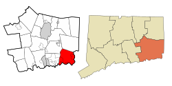
Stonington, Connecticut | |
|---|---|
Town | |
| Town of Stonington | |
 Stonington, Connecticut, August 2012 | |
| Coordinates: 41°21′54″N 71°54′24″W / 41.36500°N 71.90667°W | |
| Country | |
| U.S. state | |
| County | New London |
| Region | Southeastern CT |
| Settled | 1649 |
| Established | 1662 |
| Government | |
| • Type | Selectman-town meeting |
| • First selectman | Danielle Chesebrough |
| • Other selectmen | Ben Tamsky (D), Deborah Downie (R) |
| Area | |
• Total | 48.98 sq mi (126.85 km2) |
| • Land | 38.66 sq mi (100.12 km2) |
| • Water | 10.32 sq mi (26.72 km2) |
| Elevation | 75 ft (23 m) |
| Population (2020) | |
• Total | 18,335 |
| • Density | 370/sq mi (140/km2) |
| Time zone | UTC-5 (Eastern) |
| • Summer (DST) | UTC-4 (Eastern) |
| ZIP Codes | 06355, 06378, 06379 |
| Area code | 860/959 |
| FIPS code | 09-73770 |
| GNIS feature ID | 0213513 |
| Website | www |
Stonington is a town located in New London County, Connecticut. The municipal limits of the town include the borough of Stonington, the villages of Pawcatuck, Lords Point, and Wequetequock, and the eastern halves of the villages of Mystic and Old Mystic. Stonington is part of the Southeastern Connecticut Planning Region. The population of the town was 18,335 at the 2020 census.[2]
- ^ "2019 U.S. Gazetteer Files". United States Census Bureau. Retrieved March 7, 2021.
- ^ "Census - Geography Profile: Stonington town, New London County, Connecticut". United States Census Bureau. Retrieved December 21, 2021.


