Stonington | |
|---|---|
| Borough of Stonington | |
 | |
| Etymology: Same name as the town it's located in | |
| Nickname: The Borough | |
| Coordinates: 41°20′04″N 71°54′21″W / 41.3344°N 71.9058°W | |
| Country | |
| state | |
| County | New London |
| Region | Southeastern CT |
| Town | Stonington |
| Government | |
| • Borough Warden | Jeffrey Callahan |
| Area | |
| • Total | 2 km2 (0.7 sq mi) |
| • Land | 0.8 km2 (0.3 sq mi) |
| • Water | 0.8 km2 (0.3 sq mi) |
| Population (2020) | |
| • Total | 976 |
| • Density | 540/km2 (1,400/sq mi) |
| Time zone | UTC-5 (Eastern (EST)) |
| • Summer (DST) | UTC-4 (EDT) |
| ZIP Code | 06378 |
| Area code | 860 |
| FIPS code | 09-73700 |
| GNIS feature ID | 2378292 |
| Website | stoningtonboroughct |
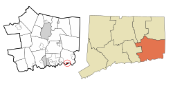
Stonington is a borough and the town center of Stonington, Connecticut, referred to by locals as "The Borough". The population was 976 at the 2020 United States Census, up from 929 in 2010.[1]
The densely built Borough of Stonington occupies a point of land that projects into Little Narragansett Bay. It has two main streets that link Cannon Square and Wadawanuck Square, named for the former Wadawanuck Hotel that brought wealthy visitors in the post-Civil War era. Its colonial, Federal, and Greek revival architectures have been preserved through the lack of traffic or modern industry, together with the borough's role as a fashionable summer residence, while the activity of one of Connecticut's last remaining fishing and lobstering fleets keeps it from being simply a quaint, historic village. There is a large community of Portuguese descent.


