Stord Municipality
Stord kommune | |
|---|---|
| Stordøen herred (historic name) | |
 View of the town of Leirvik | |
|
| |
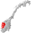
 Vestland within Norway | |
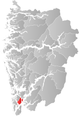
 Stord within Vestland | |
| Coordinates: 59°48′29″N 05°27′59″E / 59.80806°N 5.46639°E | |
| Country | Norway |
| County | Vestland |
| District | Sunnhordland |
| Established | 1 Jan 1838 |
| • Created as | Formannskapsdistrikt |
| Administrative centre | Leirvik |
| Government | |
| • Mayor (2023) | Sigbjørn Framnes (FrP) |
| Area | |
• Total | 143.71 km2 (55.49 sq mi) |
| • Land | 137.45 km2 (53.07 sq mi) |
| • Water | 6.27 km2 (2.42 sq mi) 4.4% |
| • Rank | #316 in Norway |
| Population (2023) | |
• Total | 19,098 |
| • Rank | #69 in Norway |
| • Density | 138.9/km2 (360/sq mi) |
| • Change (10 years) | |
| Demonyms | Stordabu / Stording[1] |
| Official language | |
| • Norwegian form | Nynorsk |
| Time zone | UTC+01:00 (CET) |
| • Summer (DST) | UTC+02:00 (CEST) |
| ISO 3166 code | NO-4614[3] |
| Website | Official website |
Stord is a municipality in Vestland county, Norway. It is located in the traditional district of Sunnhordland. Stord is sometimes called "Norway in miniature" since it has such a variety of landscapes: coastline, fjords, forests, agricultural land, and mountain areas. The administrative centre of the municipality is the town of Leirvik, which is also the largest town in the municipality and the whole region of Sunnhordland. Leirvik was declared a town in 1997. Other population centres in the municipality include the large village of Sagvåg and the smaller villages of Litlabø and Grov.[4]
The 144-square-kilometre (56 sq mi) municipality is the 316th largest by area out of the 356 municipalities in Norway. Stord is the 69th most populous municipality in Norway with a population of 19,098. The municipality's population density is 138.9 inhabitants per square kilometre (360/sq mi) and its population has increased by 5.2% over the previous 10-year period.[5][6]
- ^ "Navn på steder og personer: Innbyggjarnamn" (in Norwegian). Språkrådet.
- ^ "Forskrift om målvedtak i kommunar og fylkeskommunar" (in Norwegian). Lovdata.no.
- ^ Bolstad, Erik; Thorsnæs, Geir, eds. (26 January 2023). "Kommunenummer". Store norske leksikon (in Norwegian). Kunnskapsforlaget.
- ^ Cite error: The named reference
snlwas invoked but never defined (see the help page). - ^ Statistisk sentralbyrå. "Table: 06913: Population 1 January and population changes during the calendar year (M)" (in Norwegian).
- ^ Statistisk sentralbyrå. "09280: Area of land and fresh water (km²) (M)" (in Norwegian).

