| Strait of Juan de Fuca | |
|---|---|
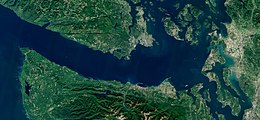
 Sentinel-2 image of the Strait of Juan de Fuca | |
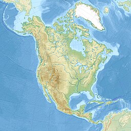
| Location | British Columbia and Washington |
| Coordinates | 48°13′30″N 123°33′30″W / 48.22500°N 123.55833°W |
| Type | Strait |
| Part of | Salish Sea |
| Basin countries | Canada and United States |
| Max. length | 96 mi (83 nmi; 154 km) |
| Max. width | 12 to 25 mi (10 to 22 nmi; 19 to 40 km) |
| Average depth | 100 m (330 ft)[1] |
The Strait of Juan de Fuca (officially named Juan de Fuca Strait in Canada)[2] is a body of water about 96 miles (83 nmi; 154 km) long[3] that is the Salish Sea's main outlet to the Pacific Ocean. The international boundary between Canada and the United States runs down the centre of the Strait.
It was named in 1787 by the maritime fur trader Charles William Barkley, captain of Imperial Eagle, for Juan de Fuca, the Greek navigator who sailed in a Spanish expedition in 1592 to seek the fabled Strait of Anián. Barkley was the first recorded person to find the strait, unless Juan de Fuca's story was true.[4] The strait was explored in detail between 1789 and 1791 by Manuel Quimper, José María Narváez, Juan Carrasco, Gonzalo López de Haro, and Francisco de Eliza.
- ^ "Nautical Charts Online - View details of Chart 18400, Strait of Georgia and Strait of Juan de Fuca". www.nauticalchartsonline.com. Retrieved 2020-09-27.
- ^ "Juan de Fuca Strait". BC Geographical Names.
- ^ U.S. Geological Survey Geographic Names Information System: Strait of Juan de Fuca
- ^ While U.S. Geological Survey Geographic Names Information System: Strait of Juan de Fuca says John Meares named the strait in 1788, most sources say it was Barkley in 1787, for example: "Juan de Fuca Strait". BC Geographical Names.; Existence of the Strait of Juan de Fuca confirmed by Captain Charles Barkley, Washington Secretary of State; Hayes, Derek (1999). Historical Atlas of the Pacific Northwest: Maps of exploration and Discovery. Sasquatch Books. p. 16. ISBN 1-57061-215-3. online at Google Books; and Pethick, Derek (1980). The Nootka Connection: Europe and the Northwest Coast 1790–1795. Vancouver: Douglas & McIntyre. pp. 24. ISBN 0-88894-279-6. It is well established that Meares tried to take credit for much of Barkley's work.


