Strandvik Municipality
Strandvik herad | |
|---|---|
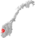
 Hordaland within Norway | |
 Strandvik within Hordaland | |
| Coordinates: 60°09′34″N 05°40′00″E / 60.15944°N 5.66667°E | |
| Country | Norway |
| County | Hordaland |
| District | Midhordland |
| Established | 1 Jan 1903 |
| • Preceded by | Fusa Municipality |
| Disestablished | 1 Jan 1964 |
| • Succeeded by | Fusa Municipality |
| Administrative centre | Strandvik |
| Area (upon dissolution) | |
| • Total | 143 km2 (55 sq mi) |
| Population (1963) | |
| • Total | 2,078 |
| • Density | 15/km2 (38/sq mi) |
| Time zone | UTC+01:00 (CET) |
| • Summer (DST) | UTC+02:00 (CEST) |
| ISO 3166 code | NO-1240[1] |
Strandvik is a former municipality in the old Hordaland county, Norway. It existed from 1903 until its dissolution in 1964. The 143-square-kilometre (55 sq mi) municipality encompassed the southern part of present-day Bjørnafjorden Municipality in Vestland county. It included the inner part of the Bjørnafjorden. The administrative centre of the municipality was the village of Strandvik where the Strandvik Church is located.[2]
- ^ Bolstad, Erik; Thorsnæs, Geir, eds. (26 January 2023). "Kommunenummer". Store norske leksikon (in Norwegian). Kunnskapsforlaget.
- ^ Store norske leksikon. "Strandvik" (in Norwegian). Retrieved 14 July 2014.