| Stratton | |
|---|---|
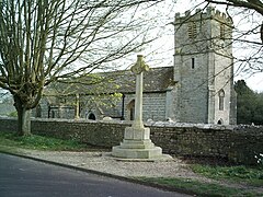
 War memorial & St. Mary's parish church | |
Location within Dorset | |
| Population | 592 [1] |
| OS grid reference | SY651938 |
| Civil parish |
|
| Unitary authority | |
| Shire county | |
| Region | |
| Country | England |
| Sovereign state | United Kingdom |
| Post town | Dorchester |
| Postcode district | DT2 |
| Dialling code | 01305 |
| Police | Dorset |
| Fire | Dorset and Wiltshire |
| Ambulance | South Western |
| UK Parliament | |
| Website | Stratton Dorset |
Stratton is a village and civil parish in Dorset, England, situated in the Frome valley about 3 miles (4.8 km) north-west of Dorchester. The parish includes the hamlets of Grimstone, Ash Hill and Wrackleford which, like the village, lie on or near the A37 trunk road. Ash Hill is a small estate east of the village near the railway. Wrackleford is a group of houses further east and centred about Wrackleford House and including Higher Wrackleford and Lower Wrackleford. In addition there are a number of isolated farms and houses including a few in an area called Langford near the Sydling Water in the north-west part of the parish.
The name Stratton means 'Farm on the Street'. The Street referred to the Roman road from Durnovaria (Dorchester) to Lindinis (Ilchester) which passes through the village.
The parish has an area of about 1,710 acres (690 ha). Most of this is agricultural land lying north of the village where the land rises from about 250 feet (76 m) to about 620 feet (190 m). Stratton parish is bounded by the parishes of Bradford Peverell, Frampton, Sydling St. Nicholas, Godmanstone and Charminster. In the 2011 census the parish had a population of 592.[1]
- ^ a b "Area: Stratton (Parish), Key Figures for 2011 Census: Key Statistics". Neighbourhood Statistics. Office for National Statistics. Retrieved 25 April 2014.
