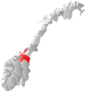
Strinda Municipality
Strinda herred | |
|---|---|
| Strinden herred (historic name) | |
 Sør-Trøndelag within Norway | |
 Strinda within Sør-Trøndelag | |
| Coordinates: 63°24′43″N 10°25′55″E / 63.41194°N 10.43194°E | |
| Country | Norway |
| County | Sør-Trøndelag |
| District | Trondheim Region |
| Established | 1 Jan 1838 |
| • Created as | Formannskapsdistrikt |
| Disestablished | 1 Jan 1964 |
| • Succeeded by | Trondheim Municipality |
| Administrative centre | Trondheim |
| Area (upon dissolution) | |
• Total | 144 km2 (56 sq mi) |
| Population (1964) | |
• Total | 44,600 |
| • Density | 310/km2 (800/sq mi) |
| Demonyms | Strinding Strindaværing[1] |
| Time zone | UTC+01:00 (CET) |
| • Summer (DST) | UTC+02:00 (CEST) |
| ISO 3166 code | NO-1660[2] |
Strinda is a former municipality in the old Sør-Trøndelag county, Norway. The 144-square-kilometre (56 sq mi) municipality existed from 1838 until its dissolution in 1964. The municipality encompassed the eastern part of what is now the municipality of Trondheim south and east of the main city center all the way southeast to the lake Jonsvatnet, and it originally included what is now the municipality of Malvik. The western part of the municipality was heavily urbanized, while the areas further east and south were more suburban. The administrative centre was actually located in the neighboring city of Trondheim, just across the Nidelva river on the Kjøpmansgata road.[3][4]
- ^ "Navn på steder og personer: Innbyggjarnamn" (in Norwegian). Språkrådet.
- ^ Bolstad, Erik; Thorsnæs, Geir, eds. (26 January 2023). "Kommunenummer". Store norske leksikon (in Norwegian). Kunnskapsforlaget.
- ^ "Strinda formannskap" (in Norwegian). Strinda Historielag. Retrieved 17 March 2018.
- ^ Thorsnæs, Geir, ed. (22 December 2015). "Strinda – tidligere kommune". Store norske leksikon (in Norwegian). Kunnskapsforlaget. Retrieved 17 March 2018.