Subic Bay International Airport Paliparang Pandaigdig ng Look ng Subic | |||||||||||
|---|---|---|---|---|---|---|---|---|---|---|---|
 Aerial view of Subic Bay International Airport | |||||||||||
| Summary | |||||||||||
| Airport type | Public | ||||||||||
| Owner/Operator | Subic Bay Metropolitan Authority | ||||||||||
| Serves | Zambales and Bataan | ||||||||||
| Location | Mabayo, Morong, Bataan, Philippines | ||||||||||
| Opened | November 1992 | ||||||||||
| Elevation AMSL | 20 m / 64 ft | ||||||||||
| Coordinates | 14°47′39″N 120°16′15″E / 14.79417°N 120.27083°E | ||||||||||
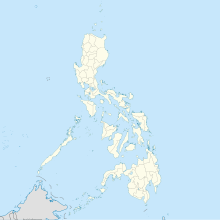
| Map | |||||||||||
 | |||||||||||
| Runways | |||||||||||
| |||||||||||

Subic Bay International Airport (IATA: SFS, ICAO: RPLB) serves as a secondary and diversion airport for Ninoy Aquino International Airport in Metro Manila and Clark International Airport in Pampanga. It also serves the immediate area of the Subic Bay Freeport Zone, the provinces of Bataan and Zambales, and the general area of Olongapo in the Philippines.
The airport was known as the Naval Air Station Cubi Point, part of the Subic Naval Base of the United States Navy before its closure.

