| Sugar Pine Dam | |
|---|---|
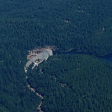
 Sugar Pine Dam from the air | |
| Country | United States |
| Location | Northern California |
| Coordinates | 39°7′47″N 120°48′5″W / 39.12972°N 120.80139°W |
| Construction began | 1979 |
| Opening date | 1982 |
| Construction cost | $71 million |
| Owner(s) | Foresthill Public Utility District |
| Operator(s) | Foresthill Public Utility District |
| Dam and spillways | |
| Type of dam | Earth fill dam |
| Impounds | North Shirttail Creek |
| Height | 205 ft (62 m) |
| Length | 689 ft (210 m) |
| Width (base) | 984 ft (300 m) |
| Dam volume | 987,500 cu ft (27,960 m3) |
| Reservoir | |
| Creates | Sugar Pine Reservoir |
| Total capacity | 6,921 acre⋅ft (8,537,000 m3) |
| Surface area | 165 acres (67 ha)[1] |
| Normal elevation | 3,609 ft (1,100 m)[2] |
Sugar Pine Dam is an earthfill embankment dam in Placer County, California, approximately 7 miles (11 km) north of Foresthill.[1] It impounds North Shirttail Creek, a tributary of the North Fork American River, and serves as the primary municipal water supply for the Foresthill community.
- ^ a b "Auburn-Folsom South Unit Project". U.S. Bureau of Reclamation. August 31, 2009. Archived from the original on 2 February 2015. Retrieved 29 September 2014.
- ^ U.S. Geological Survey Geographic Names Information System: Sugar Pine Reservoir