This article needs additional citations for verification. (November 2020) |
Sukma district | |
|---|---|
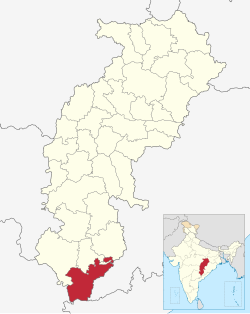
 Location in Chhattisgarh | |
| Country | |
| State | Chhattisgarh |
| Division | Bastar |
| Area | |
• Total | 5,897 km2 (2,277 sq mi) |
| Population (2011) | |
• Total | 250,159 |
| • Density | 42/km2 (110/sq mi) |
| Time zone | UTC+05:30 (IST) |
| Website | sukma |
Sukma district is the southernmost district in the Indian state of Chhattisgarh. It is located in the Bastar region, known for its tribal culture. Sukma district borders with Odisha (Malkangiri district), Telangana (Bhadradri Kothagudem district) and Andhra Pradesh (Alluri Sitharama Raju district).
Located in the southern tip of Chhattisgarh, the district was carved out of Dantewada in 2012. It is covered with semitropical forest and is mainly inhabited by Gonds and other tribals. The district has nearly 85% of its population as STs, 65% of its area is covered with the forest and an extremely low population density of merely 45 persons per km2. It also has one of the lowest literacy rates in India, 29%. One major river that flows through the district is Sabari and the district receives decent rainfalls in the monsoon season.
The district is one of the least developed districts of India. The district is severely affected by Naxalism or Maoism.
