| Sulu Sea | |
|---|---|
 Satellite image from NASA showing the internal waves formed in the Sulu Sea | |
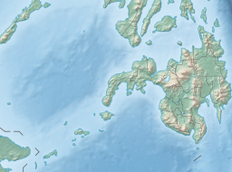
Location within the Philippines, with the island of Borneo to the southwest | |
| Location | Southeast Asia |
| Coordinates | 8°N 120°E / 8°N 120°E |
| Type | sea |
| Etymology | Sulu |
| Part of | Pacific Ocean |
| Basin countries | Malaysia and Philippines |
| Surface area | 260,000 square kilometers (100,000 sq mi) |
| Settlements | |


The Sulu Sea (Filipino: Dagat Sulu; Tausug: Dagat sin Sūg; Malay: Laut Sulu) is a body of water in the southwestern area of the Philippines, separated from the South China Sea in the northwest by Palawan[1] and from the Celebes Sea in the southeast by the Sulu Archipelago.[2] Borneo is found to the southwest and Visayas to the northeast.
The Sulu Sea contains a number of islands. The Cuyo Islands[3][4] and the Cagayan Islands are part of the province of Palawan whereas Mapun[5] and the Turtle Islands are part of the province of Tawi-Tawi.[6] Sulu Sea is also where the Tubbataha Reef National Marine Park, one of the World Heritage Sites is located.[7]
Panay Gulf is an extension of the Sulu Sea. Straits out of the Sulu Sea include the Iloilo Strait, the Guimaras Strait, and the Basilan Strait.
- ^ "Coron Bay, Philippines : UnderwaterAsia.info". www.underwaterasia.info. Archived from the original on 5 October 2017. Retrieved 23 April 2018.
- ^ "Sulu Sea, Philippines : UnderwaterAsia.info". www.underwaterasia.info. Archived from the original on 1 June 2016. Retrieved 23 April 2018.
- ^ Traveler's Companion Philippines 1998 p.214 Kirsten Ellis, Globe Pequot Press Globe Pequot, 1998
- ^ "Jewel of Sulu Sea - The Manila Times Online". www.manilatimes.net. Retrieved 23 April 2018.
- ^ "Mapun - island, Philippines". Encyclopedia Britannica. Retrieved 16 June 2020.
- ^ "Tawi Tawi - island, Philippines". Encyclopedia Britannica. Retrieved 16 June 2020.
- ^ C.Michael Hogan. 2011. Sulu Sea. Encyclopedia of Earth. Eds. P.Saundry & C.J.Cleveland. Washington DC


