| Sun River Medicine River, Pointed Rock River | |
|---|---|
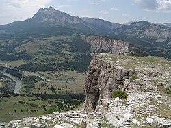
 The headwaters of the Sun River in the Rockies, near Gibson Reservoir | |
| Location | |
| Country | United States |
| State | Montana |
| Cities | Fairfield, Sun River, Vaughn, Great Falls |
| Physical characteristics | |
| Source | North Fork Sun River |
| • location | Confluence of Open Creek and McDonald Creek, Lewis and Clark County |
| • coordinates | 47°54′43″N 112°58′23″W / 47.91194°N 112.97306°W[2] |
| • elevation | 5,781 ft (1,762 m)[3] |
| 2nd source | South Fork Sun River |
| • location | Sun Lake, Lewis and Clark County |
| • coordinates | 47°20′07″N 112°53′29″W / 47.33528°N 112.89139°W[4] |
| • elevation | 6,988 ft (2,130 m)[5] |
| Source confluence | |
| • location | Near Gibson Reservoir, Lewis and Clark County |
| • coordinates | 47°37′47″N 112°51′25″W / 47.62972°N 112.85694°W[1] |
| • elevation | 4,728 ft (1,441 m)[2] |
| Mouth | Missouri River |
• location | Great Falls, Cascade County |
• coordinates | 47°29′42″N 111°18′43″W / 47.49500°N 111.31194°W[1] |
• elevation | 3,314 ft (1,010 m)[1] |
| Length | 130 mi (210 km) |
| Basin size | 1,875 sq mi (4,860 km2)[6] |
| Discharge | |
| • location | Vaughn[7] |
| • average | 669 cu ft/s (18.9 m3/s)[8] |
| • minimum | 20 cu ft/s (0.57 m3/s) |
| • maximum | 53,500 cu ft/s (1,510 m3/s) |
| Basin features | |
| River system | Missouri River watershed |
| Tributaries | |
| • left | North Fork Sun River, Muddy Creek |
| • right | South Fork Sun River, Willow Creek |
The Sun River (also called the Medicine River) is a tributary of the Missouri River in the Great Plains, approximately 130 mi (209 km) long, in Montana in the United States.
- ^ a b c U.S. Geological Survey Geographic Names Information System: Sun River
- ^ a b U.S. Geological Survey Geographic Names Information System: Sun River
- ^ https://edits.nationalmap.gov/apps/gaz-domestic/public/search/names/801259
- ^ https://edits.nationalmap.gov/apps/gaz-domestic/public/search/names/801498
- ^ https://edits.nationalmap.gov/apps/gaz-domestic/public/search/names/801565
- ^ Derived from USGS statistics for drainage area above Vaughn, MT with about 36 square miles (93 km2) added to represent drainage below this station
- ^ "USGS Gage #06089000 on the Sun River near Vaughn, Montana: Water-Data Report 2009" (PDF). National Water Information System. U.S. Geological Survey. Retrieved 2010-09-30.
- ^ "USGS Gage #06089000 on the Sun River near Vaughn, Montana: Water-Data Report 2009" (PDF). National Water Information System. U.S. Geological Survey. Retrieved 2010-09-30.
