Sund Municipality
Sund kommune | |
|---|---|
 View of an old stone fence on the island of Sotra | |
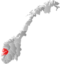
 Hordaland within Norway | |
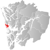
 Sund within Hordaland | |
| Coordinates: 60°13′56″N 05°06′17″E / 60.23222°N 5.10472°E | |
| Country | Norway |
| County | Hordaland |
| District | Midhordland |
| Established | 1 Jan 1838 |
| • Created as | Formannskapsdistrikt |
| Disestablished | 1 Jan 2020 |
| • Succeeded by | Øygarden Municipality |
| Administrative centre | Skogsvåg |
| Government | |
| • Mayor (2013-2019) | Kari-Anne Landro (H) |
| Area (upon dissolution) | |
• Total | 99.54 km2 (38.43 sq mi) |
| • Land | 94.68 km2 (36.56 sq mi) |
| • Water | 4.86 km2 (1.88 sq mi) 4.9% |
| • Rank | #381 in Norway |
| Population (2019) | |
• Total | 7,058 |
| • Rank | #149 in Norway |
| • Density | 74.5/km2 (193/sq mi) |
| • Change (10 years) | |
| Demonym | Sundsokning[1] |
| Official language | |
| • Norwegian form | Nynorsk |
| Time zone | UTC+01:00 (CET) |
| • Summer (DST) | UTC+02:00 (CEST) |
| ISO 3166 code | NO-1245[3] |
Sund is a former municipality in the old Hordaland county in Norway. The municipality existed from 1838 until its dissolution in 2020 when it joined Øygarden Municipality in Vestland county. It was located in the traditional district of Midhordland. The administrative centre of the municipality was the village of Skogsvåg. Other larger villages in Sund included Klokkarvik, Tælavåg, Kausland, and Hammarsland.
Sund covered the southern third of the island of Store Sotra, west of the city of Bergen. It also included many smaller, surrounding islands. Sund was a predominantly rural municipality, with no major settlements, the largest being Hammarsland with approximately 900 inhabitants (in 2013). Due to the proximity to the city of Bergen, a large proportion of the population commuted to the city to work.
Prior to its dissolution in 2020, the 100-square-kilometre (39 sq mi) municipality is the 381st largest by area out of the 422 municipalities in Norway. Sund is the 149th most populous municipality in Norway with a population of 7,058. The municipality's population density is 74.5 inhabitants per square kilometre (193/sq mi) and its population has increased by 24.5% over the last decade.[4]
- ^ "Navn på steder og personer: Innbyggjarnamn" (in Norwegian). Språkrådet.
- ^ "Forskrift om målvedtak i kommunar og fylkeskommunar" (in Norwegian). Lovdata.no.
- ^ Bolstad, Erik; Thorsnæs, Geir, eds. (26 January 2023). "Kommunenummer". Store norske leksikon (in Norwegian). Kunnskapsforlaget.
- ^ Statistisk sentralbyrå (2017). "Table: 06913: Population 1 January and population changes during the calendar year (M)" (in Norwegian). Retrieved 28 October 2017.

