Sunderland, Massachusetts | |
|---|---|
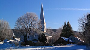
 First Congregational of Sunderland, organized in 1718 | |
 Location in Franklin County in Massachusetts | |
| Coordinates: 42°28′0″N 72°34′45″W / 42.46667°N 72.57917°W | |
| Country | United States |
| State | Massachusetts |
| County | Franklin |
| Settled | 1713 |
| Incorporated | November 12, 1718 |
| Government | |
| • Type | Open town meeting |
| Area | |
| • Total | 14.7 sq mi (38.2 km2) |
| • Land | 14.2 sq mi (36.9 km2) |
| • Water | 0.5 sq mi (1.3 km2) |
| Elevation | 748 ft (228 m) |
| Population (2020) | |
| • Total | 3,663 |
| • Density | 250/sq mi (96/km2) |
| Time zone | UTC-5 (Eastern) |
| • Summer (DST) | UTC-4 (Eastern) |
| ZIP Code | 01375 |
| Area code | 413 |
| FIPS code | 25-68400 |
| GNIS feature ID | 0618176[1] |
| Website | www |
Sunderland is a town in Franklin County, Massachusetts, United States, part of the Pioneer Valley. The population was 3,663 at the 2020 census.[2] It is part of the Springfield, Massachusetts Metropolitan Statistical Area.
Sunderland was first settled in 1713 and was officially incorporated in 1718. It was first known as Swampfield, a name which is now honored by Swampfield Road, but the name was changed to attract more residents. It was renamed in honor of Charles Spencer, the Earl of Sunderland.[3] Historically, the land was largely used for farming. Before the incorporation of Leverett in 1774, that town was a part of Sunderland's territory.
- ^ a b U.S. Geological Survey Geographic Names Information System: Sunderland, Massachusetts
- ^ "Census - Geography Profile: Sunderland town, Franklin County, Massachusetts". United States Census Bureau. Retrieved November 14, 2021.
- ^ [1], Sunderland, MA – Local Guide to the Town. Accessed April 20, 2009.
