Shorapur | |
|---|---|
City | |
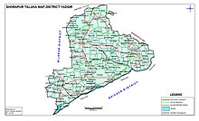
 Surapura Taluk Map | |
| Nickname(s): Surpur Paddy, Pulses and Cotton City | |
| Coordinates: 16°31′N 76°46′E / 16.52°N 76.76°E | |
| Country | |
| State | Karnataka |
| District | Yadagiri |
| Lok Sabha Constituency | Raichur |
| Elevation | 428 m (1,404 ft) |
| Population (2011) | |
• Total | 412,291 |
| Languages | |
| • Official | Kannada |
| Time zone | UTC+5:30 (IST) |
| PIN | 585224 |
| Telephone code | 08443 |
| Vehicle registration | KA 33 |

Shorapur, is a city and taluka in Yadgir district in the Indian state of Karnataka and a historical place. Surapura was the land of the famous prince of Surapura aasthana, Raja Venkatappa Nayaka, the young rebel freedom fighter against British rule.
