Surrey | |
|---|---|
| Coordinates: 51°15′N 0°27′W / 51.25°N 0.45°W | |
| Sovereign state | United Kingdom |
| Constituent country | England |
| Region | South East |
| Established | before 1066 |
| Time zone | UTC+0 (GMT) |
| • Summer (DST) | UTC+1 (BST) |
| UK Parliament | List of MPs |
| Police | Surrey Police |
| Largest town | Woking |
| Ceremonial county | |
| Lord Lieutenant | Michael More-Molyneux |
| High Sheriff | Julie Llewelyn (2021–22)[1] |
| Area | 1,663 km2 (642 sq mi) |
| • Rank | 35th of 48 |
| Population (2022)[2] | 1,214,540 |
| • Rank | 12th of 48 |
| Density | 731/km2 (1,890/sq mi) |
| Non-metropolitan county | |
| County council | Surrey County Council |
| Control | Conservative |
| Admin HQ | Woodhatch Place, Reigate |
| Area | 1,663 km2 (642 sq mi) |
| • Rank | 20th of 21 |
| Population (2022)[3] | 1,214,540 |
| • Rank | 5th of 21 |
| Density | 731/km2 (1,890/sq mi) |
| ISO 3166-2 | GB-SRY |
| GSS code | E10000030 |
| ITL | UKJ23 |
| Website | surreycc |
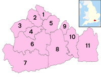
| Districts | |
 Districts of Surrey | |
| Districts | |
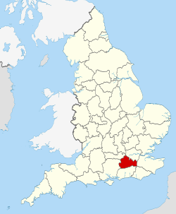
Surrey (/ˈsʌri/)[4] is a ceremonial county in South East England. It is bordered by Greater London to the northeast, Kent to the east, East and West Sussex to the south, and Hampshire and Berkshire to the west. The largest settlement is Woking.
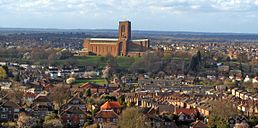
The county has an area of 1,663 km2 (642 square miles) and a population of 1,214,540. Much of the north of the county forms part of the Greater London Built-up Area, which includes the suburbs within the M25 motorway as well as Woking (103,900), Guildford (77,057), and Leatherhead (32,522). The west of the county contains part of built-up area which includes Camberley, Farnham, and Frimley and which extends into Hampshire and Berkshire. The south of the county is rural, and its largest settlements are Horley (22,693) and Godalming (22,689). For local government purposes Surrey is a non-metropolitan county with eleven districts. The county historically included much of south-west Greater London but excluded what is now the borough of Spelthorne, which was part of Middlesex. It is one of the home counties.
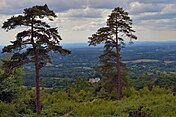
The defining geographical feature of the county is the North Downs, a chalk escarpment which runs from the south-west to north-east and divides the densely populated north from the more rural south; it is pierced by the rivers Wey and Mole, both tributaries of the Thames. The north of the county is a lowland, part of the Thames basin. The south-east is part of the Weald, and the south-west contains the Surrey Hills and Thursley, Hankley and Frensham Commons, an extensive area of heath. The county has the densest woodland cover in England, at 22.4 per cent.
- ^ "Home - High Sheriff of Surrey". Archived from the original on 5 January 2022. Retrieved 5 January 2022.
- ^ "Mid-2022 population estimates by Lieutenancy areas (as at 1997) for England and Wales". Office for National Statistics. 24 June 2024. Retrieved 26 June 2024.
- ^ "Mid-Year Population Estimates, UK, June 2022". Office for National Statistics. 26 March 2024. Retrieved 3 May 2024.
- ^ "Surrey | Definition of surrey in English by Oxford Dictionaries". Oxford University Press. Archived from the original on 8 October 2017. Retrieved 7 October 2017.


