Sussex County | |
|---|---|
 Sussex County Courthouse in Georgetown | |
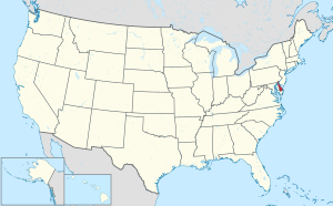
 Location within the U.S. state of Delaware | |
 Delaware's location within the U.S. | |
| Coordinates: 38°41′N 75°20′W / 38.68°N 75.34°W | |
| Country | |
| State | |
| Founded | August 8, 1683 |
| Named for | Sussex, England |
| Seat | Georgetown |
| Largest city | Seaford |
| Area | |
| • Total | 1,196 sq mi (3,100 km2) |
| • Land | 936 sq mi (2,420 km2) |
| • Water | 260 sq mi (700 km2) 21.7% |
| Population (2020) | |
| • Total | 237,378 |
| • Density | 253.61/sq mi (97.92/km2) |
| Time zone | UTC−5 (Eastern) |
| • Summer (DST) | UTC−4 (EDT) |
| Congressional district | At-large |
| Website | www |
Sussex County is a county in the southern part of the U.S. state of Delaware, on the Delmarva Peninsula. As of the 2020 census, the population was 237,378, making it the state's second most populated county only behind New Castle and ahead of Kent.[1] The county seat is Georgetown.[2]
The first European settlement in the state of Delaware was founded by the Dutch in 1631 near the present-day town of Lewes on the Atlantic Coast. However, Sussex County was not organized until 1683 under English colonial rule.
Sussex County is included in the Salisbury, MD-DE metropolitan statistical area which encompasses much of central Delmarva.
- ^ "State & County QuickFacts". United States Census Bureau. Archived from the original on July 17, 2011. Retrieved June 12, 2014.
- ^ "Find a County". National Association of Counties. Archived from the original on December 26, 2018. Retrieved June 7, 2011.

