| Sutton Lane Ends | |
|---|---|
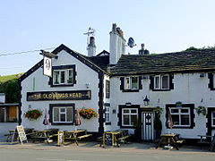
 The Old Kings Head, Gurnett | |
Location within Cheshire | |
| Area | 0.3950 km2 (0.1525 sq mi) |
| Population | 936 (2020 estimate) |
| • Density | 2,370/km2 (6,100/sq mi) |
| OS grid reference | SJ930712 |
| Civil parish |
|
| Unitary authority | |
| Ceremonial county | |
| Region | |
| Country | England |
| Sovereign state | United Kingdom |
| Post town | MACCLESFIELD |
| Postcode district | SK11 |
| Dialling code | 01260 |
| Police | Cheshire |
| Fire | Cheshire |
| Ambulance | North West |
| UK Parliament | |
Sutton Lane Ends or Sutton is a semi-rural village and civil parish, approximately one mile south of Macclesfield. In 2020 it had an estimated population of 936.[1] The parish includes the villages of Langley and Oakgrove and the hamlets of Gurnett, Jarman and Lyme Green. Sutton is in the unitary authority of Cheshire East and the ceremonial county of Cheshire, England. The rivers Bollin and Rosendale run through Sutton Lane Ends, as does the Macclesfield Canal.
The population of the entire civil parish is 2,464.[2] In the past, the community was centred on farming, forestry and textiles; however, since these industries declined, most of the population now travel to nearby Macclesfield or Manchester for employment.[citation needed]
Sutton Lane Ends has had an Anglican church, Sutton St. James, since 1840. The community of Sutton is served by a village shop, primary school (Hollinhey Primary School) and five public houses.
- ^ "Sutton Lane Ends". City Population De. Retrieved 1 December 2021.
- ^ 2001 census details Accessed 15 May 2007.
