| Swafield | |
|---|---|
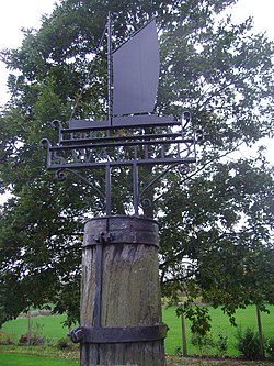
 The Village sign | |
Location within Norfolk | |
| Area | 6.43 km2 (2.48 sq mi) |
| Population | 315 (parish, 2011 census) |
| • Density | 49/km2 (130/sq mi) |
| OS grid reference | TG2832 |
| • London | 132 miles (212 km) |
| Civil parish |
|
| District | |
| Shire county | |
| Region | |
| Country | England |
| Sovereign state | United Kingdom |
| Post town | NORTH WALSHAM |
| Postcode district | NR28 |
| Police | Norfolk |
| Fire | Norfolk |
| Ambulance | East of England |
| UK Parliament | |
Swafield is a village and a civil parish in the English county of Norfolk.[1] The village is 16.4 miles (26.4 km) north north east of Norwich, 10.1 miles (16.3 km) south south east of Cromer and 133 miles (214 km) north-east of London. The village lies 1.4 miles (2.3 km) north of the town of North Walsham. The village sits astride the B1145[2] Kings Lynn to Mundesley road that bisects North Norfolk west to east. The nearest railway station is at North Walsham for the Bittern Line which runs between Sheringham and Norwich. The nearest airport is Norwich International Airport. The parish had in 2001 census, a population of 273, including Bradfield and increasing to 315 at the 2011 Census.[3] For the purposes of local government, the parish falls within the district of North Norfolk.
- ^ OS Explorer Map 252 - Norfolk Coast East. ISBN 978-0-319-23815-8.
- ^ County A to Z Atlas, Street & Road maps Norfolk, ISBN 978-1-84348-614-5
- ^ "Parish population 2011". Retrieved 31 August 2015.
