| Swan Bay | |
|---|---|
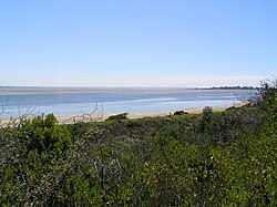
 Swan Bay at low tide, looking north from Queenscliff | |
Location in Victoria | |
 Map of Swan Bay | |
| Location | Bellarine Peninsula, Victoria |
| Coordinates | 38°13′43″S 144°39′12″E / 38.22861°S 144.65333°E[1] |
| Type | Saline, Permanent, Natural |
| Primary inflows | Yarram Creek, Frederick Mason Creek |
| Primary outflows | Port Phillip |
| Basin countries | Australia |
| Surface area | 30 km2 (12 sq mi) |
| Average depth | 2 m (6 ft 7 in) |
| Max. depth | 5 m (16 ft) |
| Islands | Duck, Mangrove, Rabbit, Sand, Stingaree, Swan, Tip |
| Settlements | Queenscliff, St Leonards |
The Swan Bay is a shallow, 30-square-kilometre (12 sq mi) marine embayment at the eastern end of the Bellarine Peninsula in Port Phillip, Victoria, Australia. The township of Queenscliff lies at its southern end, and St Leonards at its northern. It is partly separated from Port Phillip by Swan Island, Duck Island and Edwards Point. Most of the area is included in the Port Phillip Heads Marine National Park as well as being listed as a wetland of international importance under the Ramsar Convention as part of the Port Phillip Bay (Western Shoreline) and Bellarine Peninsula Ramsar Site.[2] The bay is part of the Swan Bay and Port Phillip Bay Islands Important Bird Area, identified as such by BirdLife International because of its importance for orange-bellied parrots, waders and seabirds.[3]
Matthew Flinders named the bay "Swan Ponds" after its black swans, up to 2,700 of which can be seen in summer and early autumn.
- ^ "Swans Bay (VIC)". Gazetteer of Australia online. Geoscience Australia, Australian Government.
- ^ Parks Victoria. (2006). Port Phillip Heads Marine National Park Management Plan. Parks Victoria: Melbourne. ISBN 0-7311-8349-5
- ^ "IBA: Swan Bay and Port Phillip Bay Islands". Birdata. Birds Australia. Retrieved 26 October 2011.
