| Sweet Track | |
|---|---|
 | |
| Location | Shapwick Heath, Somerset Levels, England |
| Coordinates | 51°09′51″N 2°49′35″W / 51.16417°N 2.82639°W |
| Built | 3807 or 3806 BC |
| Designated | 13 June 1996[1] |
| Reference no. | 27978 (was Somerset 399) |
| Designated | 22 April 1996[1] |
| Reference no. | 27979 (was Somerset 400) |
The Sweet Track is an ancient trackway, or causeway, in the Somerset Levels, England, named after its finder, Ray Sweet. It was built in 3807 BC (determined using dendrochronology - Tree-ring dating) and is the second-oldest timber trackway discovered in the British Isles, dating to the Neolithic. The Sweet Track was predominantly built along the course of an earlier structure, the Post Track.
The track extended across the now largely drained marsh between what was then an island at Westhay and a ridge of high ground at Shapwick, a distance close to 1,800 metres (5,900 ft) or around 1.1 mi.[2] The track is one of a network that once crossed the Somerset Levels. Various artifacts and prehistoric finds, including a jadeitite ceremonial axe head, have been found in the peat bogs along its length.[3]
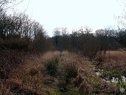
Construction was of crossed wooden poles, driven into the waterlogged soil to support a walkway that consisted mainly of planks of oak, laid end-to-end. The track was used for a period of only around ten years and was then abandoned, probably due to rising water levels. Following its discovery in 1970, most of the track has been left in its original location, with active conservation measures taken, including a water pumping and distribution system to maintain the wood in its damp condition. Some of the track is stored at the British Museum and at the Museum of Somerset in Taunton. A reconstruction has been made on which visitors can walk, on the same line as the original, in Shapwick Heath National Nature Reserve.
- ^ a b Cite error: The named reference
sshersweettrackwas invoked but never defined (see the help page). - ^ "Science: The day the Sweet Track was built". New Scientist. 16 June 1990. Archived from the original on 11 March 2010. Retrieved 13 October 2021.
- ^ Coles, John; Orme, Bryony; Bishop, A. C. & Woolley, A. R. (September 1974). "A jade axe from the Somerset Levels". Antiquity. 48 (191): 216–220. doi:10.1017/S0003598X00057987.
