Ta Phraya
ตาพระยา | |
|---|---|
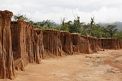
 Lalu, a local rock formations and tourist attraction | |
 District location in Sa Kaeo province | |
| Coordinates: 14°0′22″N 102°48′21″E / 14.00611°N 102.80583°E | |
| Country | Thailand |
| Province | Sa Kaeo |
| Seat | Ta Phraya |
| Area | |
• Total | 642.345 km2 (248.011 sq mi) |
| Population (2005) | |
• Total | 52,284 |
| • Density | 81.4/km2 (211/sq mi) |
| Time zone | UTC+7 (ICT) |
| Postal code | 27180 |
| Geocode | 2703 |
Ta Phraya (Thai: ตาพระยา, pronounced [tāː pʰrā.jāː]) is the northeasternmost district (amphoe) of Sa Kaeo province, eastern Thailand.