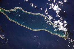
 NASA picture of Takaroa Atoll | |
| Geography | |
|---|---|
| Location | Pacific Ocean |
| Coordinates | 14°27′S 144°59′W / 14.450°S 144.983°W |
| Archipelago | Tuamotus |
| Area | 93 km2 (36 sq mi) (lagoon) 20 km2 (8 sq mi) (above water) |
| Length | 24.7 km (15.35 mi) |
| Width | 7 km (4.3 mi) |
| Administration | |
France | |
| Overseas collectivity | French Polynesia |
| Administrative subdivision | Îles Tuamotu-Gambier |
| Commune | Takaroa |
| Largest settlement | Teavaroa |
| Demographics | |
| Population | 537[1] (2022) |
Takaroa | |
|---|---|
 | |
| Coordinates: 14°27′00″S 144°58′59″W / 14.45°S 144.983°W | |
| Country | France |
| Overseas collectivity | French Polynesia |
| Subdivision | Îles Tuamotu-Gambier |
| Area 1 | 26 km2 (10 sq mi) |
| Population (2022)[1] | 1,050 |
| • Density | 40/km2 (100/sq mi) |
| Time zone | UTC−10:00 |
| INSEE/Postal code | 98749 /98781 |
| Elevation | 0 m (0 ft) |
| 1 French Land Register data, which excludes lakes, ponds, glaciers > 1 km2 (0.386 sq mi or 247 acres) and river estuaries. | |
Takaroa, Taka-roa or Takapua, is an atoll in the Tuamotu group in French Polynesia. It has a length of 27.4 kilometres (17.0 miles) and a width of 7 km (4 mi); its land area is 20 square kilometres (8 square miles).
The nearest land is Takapoto Atoll, located 10 kilometres (6 miles) to the southwest.
Fine pearls, including black pearls, were obtained in the lagoon of Takaroa.[citation needed]
Geographically Takaroa is part of the King George Islands (Iles du Roi Georges) subgroup, which includes Ahe, Manihi, Takapoto, Takaroa and Tikei.
Takaroa Atoll has 537 inhabitants (2022).[1] The main village is Teavaroa.
Takaroa is the northernmost atoll in French Polynesia.
Takaroa is located in the Tuamotu Islands.
- ^ a b c "Les résultats du recensement de la population 2022 de Polynésie française" [Results of the 2022 population census of French Polynesia] (PDF) (in French). Institut de la statistique de la Polynésie française. January 2023.

