This article needs additional citations for verification. (February 2012) |
Tama
多摩区 | |
|---|---|
| Tama Ward | |
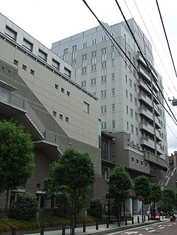
 Tama Ward Office | |
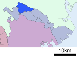
 Location of Tama in Kanagawa Prefecture | |
| Coordinates: 35°37′11″N 139°33′43″E / 35.61972°N 139.56194°E | |
| Country | Japan |
| Region | Kantō |
| Prefecture | Kanagawa |
| City | Kawasaki |
| Established | April 1, 1972 |
| Area | |
• Total | 20.49 km2 (7.91 sq mi) |
| Population (March 2010) | |
• Total | 211,221 |
| • Density | 10,310/km2 (26,700/sq mi) |
| Time zone | UTC+9 (Japan Standard Time) |
| - Tree | Flowering Dogwood, Nashi Pear |
| - Flower | Viola, Peach |
| Address | 1775-1 Noborito, Tama-ku Kawasaki-shi, Kanagawa-ken 214-8570 |
| Website | www |
Tama-ku (多摩区) is one of the seven wards of the city of Kawasaki in Kanagawa Prefecture, Japan. As of 2010, the ward has an estimated population of 211,221 and a population density of 10,310 persons per km2. The total area is 20.49 km2.

