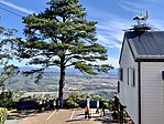
| Tamborine Mountain | |
|---|---|
Left to right; Bavarian Grill Haus & Red Baron Brewery, The Polish Place Gallery Walk, Tamborine Mountain, Tamborine Mountain Botanic Gardens | |
| Highest point | |
| Elevation | 525 m (1,722 ft) |
| Naming | |
| Native name | Jambreen (Minjungbal) |
| Geography | |
| Location | Queensland, Australia |
| Parent range | Great Dividing Range |
| Geology | |
| Age of rock | Aquitanian |
| Mountain type | Shield volcano |
| Tamborine Mountain Queensland | |||||||||||||||
|---|---|---|---|---|---|---|---|---|---|---|---|---|---|---|---|
| Coordinates | 27°58′11″S 153°11′58″E / 27.9697°S 153.1994°E | ||||||||||||||
| Population | 8,105 (2021 census)[1] | ||||||||||||||
| • Density | 190.71/km2 (493.9/sq mi) | ||||||||||||||
| Postcode(s) | 4272 | ||||||||||||||
| Area | 42.5 km2 (16.4 sq mi) | ||||||||||||||
| Time zone | AEST (UTC+10:00) | ||||||||||||||
| LGA(s) | Scenic Rim Region | ||||||||||||||
| State electorate(s) | Scenic Rim | ||||||||||||||
| Federal division(s) | Wright | ||||||||||||||
| |||||||||||||||
Tamborine Mountain, also simply known as Mount Tamborine, is a plateau, geographic subregion[2] and locality in the Scenic Rim Region of Queensland, Australia.[3][4] In the 2021 census, Tamborine Mountain had a population of 8,105 people.[1]
- ^ a b Cite error: The named reference
Census2021was invoked but never defined (see the help page). - ^ "Region & Suburbs: About the Tamborine Mountain Region". Visit Tamborine Mountain. n.d. Retrieved 15 September 2024.
{{cite web}}: CS1 maint: url-status (link) - ^ "Tamborine Mountain – plateau in the Scenic Rim Region (entry 33236)". Queensland Place Names. Queensland Government. Retrieved 3 March 2022.
- ^ "Tamborine Mountain – locality in Scenic Rim Region (entry 48962)". Queensland Place Names. Queensland Government. Retrieved 13 February 2022.


