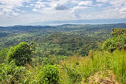
Tanganyika
Province du Tanganyika (French) Bukata wa Tanganyika (Luba-Katanga) | |
|---|---|
 | |
 Tanganyika Province | |
 Interactive map of Tanganyika Province in the Democratic Republic of the Congo | |
| Coordinates: 6°41′S 28°04′E / 6.69°S 28.07°E | |
| Country | |
| Established | 2015 |
| Named for | Lake Tanganyika |
| Capital | Kalemie |
| Government | |
| • Governor | Christian Kitungwa |
| Area | |
• Total | 134,940 km2 (52,100 sq mi) |
| Population (2015) | |
• Total | 3,062,000 |
| • Density | 23/km2 (59/sq mi) |
| Time zone | UTC+2 (CAT) |
| License Plate Code | |
| Official language | French |
| National language | KiLuba |
| Website | tanganyika |
Tanganyika (Swahili: Jimbo la Tanganyika) is one of the 21 provinces of the Democratic Republic of the Congo created in the 2015 repartitioning. Tanganyika, Haut-Katanga, Haut-Lomami and Lualaba provinces are the result of the splitting up of the former Katanga province.[1] Tanganyika was formed from the Tanganyika district whose town of Kalemie was elevated to capital city of the new province.
The new province's territory corresponds to the historic Nord-Katanga province that existed in the early period of post-colonial Democratic Republic of the Congo between 1962 and 1966.
- ^ "Le Katanga officiellement démembré en quatre nouvelles provinces". Radio Okapi (in French). 16 July 2015. Archived from the original on 19 July 2015. Retrieved 8 June 2020.