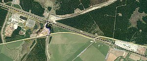
Tangiwai railway station | |||||||||||
|---|---|---|---|---|---|---|---|---|---|---|---|
 Tangiwai railway station on 1966 map | |||||||||||
| General information | |||||||||||
| Location | New Zealand | ||||||||||
| Coordinates | 39°28′07″S 175°35′37″E / 39.468628°S 175.593744°E | ||||||||||
| Elevation | 700 m (2,300 ft) | ||||||||||
| Line(s) | North Island Main Trunk | ||||||||||
| Distance | Wellington 299.49 km (186.09 mi) | ||||||||||
| History | |||||||||||
| Opened | 12 August 1907 | ||||||||||
| Closed | goods 13 October 1986 passenger 26 November 1978 | ||||||||||
| Electrified | June 1988 | ||||||||||
| Previous names | Waitangi until 24 July 1910 | ||||||||||
| Services | |||||||||||
| |||||||||||
Tangiwai was a station on the North Island Main Trunk line,[1] in the Ruapehu District of New Zealand. The station served the settlement of Tangiwai.[2] The nearby pulp and saw mills are now one of the main sources of freight on NIMT.[3] In 1953 the Tangiwai disaster occurred when the nearby bridge over the Whangaehu River was swept away.
Tangiwai has one of four substations supplying power to NIMT's electric trains.[4]

- ^ Scoble, Juliet. "Names & Opening & Closing Dates of Railway Stations in New Zealand 1863 to 2010" (PDF). Rail Heritage Trust of New Zealand.
- ^ New Zealand Railway and Tramway Atlas (Fourth ed.). Quail Map Co. 1993. ISBN 0-900609-92-3.
- ^ "KiwiRail Commercial Review" (PDF). December 2014.
- ^ "KiwiRail SF6 Work. PBA News" (PDF). October 2016.