Tank District
ضلع ٹانک ټانک ولسوالۍ | |
|---|---|
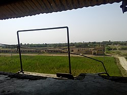
 View from Tank Railway Station | |
 Tak District (red) in Khyber Pakhtunkhwa | |
| Country | |
| Province | |
| Division | Dera Ismail Khan |
| Headquarters | Tank |
| Government | |
| • Type | District Administration |
| • Deputy Commissioner | N/A |
| • District Police Officer | N/A |
| • District Health Officer | N/A |
| Area | |
| • District of Khyber Pakhtunkhwa | 2,900 km2 (1,100 sq mi) |
| Population (2023)[1] | |
| • District of Khyber Pakhtunkhwa | 470,293 |
| • Density | 160/km2 (420/sq mi) |
| • Urban | 49,172 |
| • Rural | 421,121 |
| Time zone | UTC+5 (PST) |
| Number of Tehsils | 1 |
| Number of Union councils | 16 |
| Website | tank |
Tank District (Pashto: ټانک ولسوالۍ, Urdu: ضلع ٹانک ṭāṅk; Saraiki: ٹاک ṭāk) is a district in the Dera Ismail Khan Division of the Khyber Pakhtunkhwa province of Pakistan.
The city of Tank is the headquarter of the district, which consists of Union Council City I and Union Council City II. There are sixteen Union councils in the district Tank. Until 1992, Tank was a tehsil within Dera Ismail Khan district.[2]: 1 Tank is bordered with the district of Lakki Marwat in the northeast, Dera Ismail Khan in the east, FR Tank in the north and the South Waziristan district in the west. The temperature of Tank reaches 110–120 °F in summer. However, in the winter, it is normal. People of the mountainous regions of the west usually come to Tank to avoid cold weather and then return during the summer.