| Tantiusques | |
|---|---|
 Tantiusques | |
 | |
| Location | Massachusetts, United States |
| Coordinates | 42°3′26″N 72°7′52″W / 42.05722°N 72.13111°W |
| Established | 1962 |
| Operator | The Trustees of Reservations |
| Website | Tantiusques |
Tantiusques Reservation | |
| Location | Leadmine Rd., Sturbridge, Massachusetts |
|---|---|
| Area | 15 acres (6.1 ha) |
| Built | 1643 |
| NRHP reference No. | 83004141[1] |
| Added to NRHP | October 6, 1983 |
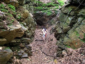
Tantiusques ("Tant-E-oos-kwiss") is a 57-acre (230,000 m2) open space reservation and historic site registered with the National Register of Historic Places. The reservation is located in Sturbridge, Massachusetts, and is owned and managed by The Trustees of Reservations; it is notable for its historic, defunct graphite mines.[2] This is a rural area with much of the adjacent and surrounding area undeveloped and forested. The reservation is entirely forested with oak-hickory forest and red maple in the wet areas and mountain laurel abundant throughout the understory. The name Tantiusques comes from a Nipmuc word meaning “the place between two low hills." The Nipmuc used the graphite to make ceremonial paints. The property also contains the ruins of a 19th-century period house that belonged to a mine worker of mixed African American and Native American ancestry.
- ^ "National Register Information System". National Register of Historic Places. National Park Service. July 9, 2010.
- ^ "Tantiusques". The Trustees of Reservations. Retrieved July 7, 2021.

