Taos, New Mexico | |
|---|---|
 Taos Plaza and the Hotel La Fonda, within the Taos Downtown Historic District | |
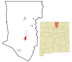
 Location of Taos, New Mexico | |
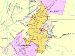
 U.S. Census map | |
| Coordinates: 36°23′13″N 105°34′48″W / 36.38694°N 105.58000°W | |
| Country | United States |
| State | New Mexico |
| County | Taos |
| Founded | 1795[1] |
| Incorporated | 1934 |
| Named for | Taos Pueblo |
| Government | |
| • Type | Mayor-Council-Manager |
| • Mayor | Pascualito M. Maestas[2] |
| Area | |
• Total | 6.04 sq mi (15.64 km2) |
| • Land | 6.04 sq mi (15.64 km2) |
| • Water | 0.00 sq mi (0.00 km2) |
| Elevation | 6,969 ft (2,124 m) |
| Population | |
• Total | 6,474 |
| • Density | 1,072.03/sq mi (413.94/km2) |
| Time zone | UTC−7 (Mountain (MST)) |
| • Summer (DST) | UTC−6 (MDT) |
| ZIP code | 87571 |
| Area code | 575 |
| FIPS code | 35-76200 |
| GNIS feature ID | 2413366[4] |
| Website | www.taosgov.com |
Taos (/taʊs/) is a town in Taos County, in the north-central region of New Mexico in the Sangre de Cristo Mountains. Initially founded in 1615, it was intermittently occupied until its formal establishment in 1795 by Nuevo México Governor Fernando Chacón to act as fortified plaza and trading outpost for the neighboring Native American Taos Pueblo (the town's namesake) and Hispano communities, including Ranchos de Taos, Cañon, Taos Canyon, Ranchitos, El Prado, and Arroyo Seco. The town was incorporated in 1934. As of the 2021, its population was 6,567.[6]
Taos is the county seat of Taos County. The English name Taos derives from the native Taos language meaning "(place of) red willows".
Taos is the principal town of the Taos, NM, Micropolitan Statistical Area, which includes all of Taos County.
- ^ "Taos History and Timeline". Taos County Historical Society. Retrieved November 27, 2019.
- ^ "Pascualito Maestas | Taos, NM". www.taosnm.gov. Retrieved September 4, 2024.
- ^ "ArcGIS REST Services Directory". United States Census Bureau. Retrieved October 12, 2022.
- ^ a b U.S. Geological Survey Geographic Names Information System: Taos, New Mexico
- ^ Cite error: The named reference
USCensusDecennial2020CenPopScriptOnlywas invoked but never defined (see the help page). - ^ "F.A.Q". Taos.org. Retrieved September 4, 2024.


