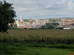
Taquaritinga | |
|---|---|
 | |
 Location in São Paulo state | |
| Coordinates: 21°24′21″S 48°30′18″W / 21.40583°S 48.50500°W | |
| Country | Brazil |
| Region | Southeast |
| State | São Paulo |
| Area | |
| • Total | 594 km2 (229 sq mi) |
| Population (2020 [1]) | |
| • Total | 57,364 |
| • Density | 97/km2 (250/sq mi) |
| Time zone | UTC-03:00 (BRT) |
| • Summer (DST) | UTC-02:00 (BRST) |
Taquaritinga is a city in the Central North area of the State of São Paulo, Brazil. The population is 57,364 (2020 est.) in an area of 594 km².[2] The population is formed mostly by European descendants (Italians, Spaniards, and Portuguese). Afro-Brazilians and Japanese-Brazilians are important minority groups.
The climate is tropical of altitude with dry mild winter and hot rainy summer. The economy of the city is based in agrobusiness (sugarcane, orange, lemon, and fruits) and services. The city has an old and regionally famous music school (Conservatório Santa Cecília), an ETEC (Technical School), and three colleges. The most important of them, FATEC, is a public one with courses on technology. Clube Atlético Taquaritinga, founded in 1942, is the football club of the city. The club plays its home matches at Estádio Adail N. da Silva, which has a maximum capacity of approximately 20,000 people.


