| Taui Kava | |
|---|---|
 Taui river basin | |
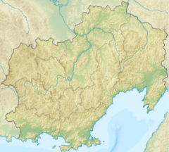
Mouth location in Magadan Oblast, Russia | |
| Location | |
| Country | Magadan Oblast, Russia |
| Physical characteristics | |
| Source | |
| • location | Confluence of the Rasava and Lozovaya in Khabarovsk Krai |
| • coordinates | 59°52′59″N 145°39′10″E / 59.88306°N 145.65278°E |
| • elevation | 125 m (410 ft) |
| Mouth | Sea of Okhotsk |
• location | Taui Bay |
• coordinates | 59°37′59″N 149°05′47″E / 59.63306°N 149.09639°E |
• elevation | 0 m (0 ft) |
| Length | 378 km (235 mi) |
| Basin size | 25,900 km2 (10,000 sq mi) |
| Discharge | |
| • average | 347 m3/s (12,300 cu ft/s) |
The Taui (Russian: Тауй), also known as Kava (Russian: Кава) for part of its course, is a river in Khabarovsk Krai and Magadan Oblast, Russian Far East. It has a drainage basin of 25,900 square kilometres (10,000 sq mi).[1][2]
The river is a spawning ground for salmon and is part of the Magadan Nature Reserve. Its last stretch is navigable.[3]
- ^ "Река Тауй (в верховье Кава) in the State Water Register of Russia". textual.ru (in Russian).
- ^ 1,000,000 scale Operational Navigation Chart; Sheet D-8
- ^ Cite error: The named reference
WRwas invoked but never defined (see the help page).
