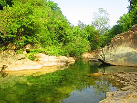
| Taza National Park | |
|---|---|
 | |
| Location | Jijel Province, Algeria |
| Nearest city | Taza, Algeria |
| Coordinates | 36°36′N 5°30′E / 36.600°N 5.500°E |
| Area | 38.07 km² |
| Established | 1923 |
| Website | http://www.pntaza.dz |
 | |
The Taza National Park (Arabic:الحظيرة الوطنية تازة) is one of the smaller national parks of Algeria. It is located in Jijel Province in the mountainous region of the Tell Atlas, and is named after the nearby city of Taza. Its total area is 3,807 hectares (9,410 acres) and it includes parts of the forested area of the Guerrouch massif. The lower parts of the park seldom experience frost and are relatively warm and dry, while the peaks may have a covering of snow in winter. The annual precipitation in the park ranges from 1,000 to 1,400 millimetres (39 to 55 in) and the annual mean temperature is around 18 °C (64 °F).[1][2]
- ^ Harrap, Simon (2010). Tits, Nuthatches and Treecreepers. Bloomsbury Publishing. p. 137. ISBN 978-1-4081-3458-0.
- ^ Taza National Park on Birdlife.org
