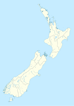
Te Kauwhata railway station | |||||||||||
|---|---|---|---|---|---|---|---|---|---|---|---|
 Wairangi Railway Station about 1900 | |||||||||||
| General information | |||||||||||
| Location | New Zealand | ||||||||||
| Coordinates | 37°24′18″S 175°08′31″E / 37.40504°S 175.141897°E | ||||||||||
| Elevation | 12 m (39 ft) | ||||||||||
| Line(s) | North Island Main Trunk | ||||||||||
| Distance | Wellington 591.52 km (367.55 mi) | ||||||||||
| History | |||||||||||
| Opened | 13 August 1877 | ||||||||||
| Closed | 24 November 1985 | ||||||||||
| Previous names | Wairangi to Waerenga in 1897 Wairangi to 28 May 1911 | ||||||||||
| Passengers | |||||||||||
| 1944 | 16,112 | ||||||||||
| Services | |||||||||||
| |||||||||||
| |||||||||||
Te Kauwhata was a flag station on the North Island Main Trunk line, in the Waikato District of New Zealand, 54 mi (87 km) south of Auckland.[1] It was 591.52 km (367.55 mi) north of Wellington, 3.32 km (2.06 mi) north of Rangiriri, 6.72 km (4.18 mi) south of Whangamarino and 12 m (39 ft) above sea level.[2]
The name was changed from Wairangi to Waerenga in 1897[3] and to Te Kauwhata on 28 May 1911.[4] Initially the station served a state experimental farm, but, from 1912, Te Kauwhata township was created.[5]

- ^ "Page 6 Advertisements Column 3 (New Zealand Herald, 1882-03-31)". paperspast.natlib.govt.nz National Library of New Zealand. Retrieved 20 May 2017.
- ^ New Zealand Railway and Tramway Atlas (Fourth ed.). Quail Map Co. 1993. ISBN 0-900609-92-3.
- ^ "WDC District Plan Review – Built Heritage Assessment Historic Overview – Te Kauwhata & District" (PDF). Waikato District Council. 2018. Retrieved 14 March 2020.
- ^ Scoble, Juliet. "Names & Opening & Closing Dates of Railway Stations in New Zealand 1863 to 2010" (PDF). Rail Heritage Trust of New Zealand. Retrieved 14 March 2020.
- ^ "COUNTRY NEWS. Te Kauwhata surveying work NEW ZEALAND HERALD". paperspast.natlib.govt.nz. 26 December 1912. Retrieved 14 March 2020.
