Tecate, Baja California | |
|---|---|
|
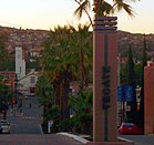
Top: Parque Miguel Hidalgo (left) and President Lázaro Cárdenas Street (right); bottom: aerial view | |
| Coordinates: 32°34′20″N 116°38′25″W / 32.57222°N 116.64028°W | |
| Country | Mexico |
| State | Baja California |
| Municipality | Tecate |
| Founded | October 12, 1892[2] |
| Government | |
| • Type | Ayuntamiento |
| • Municipal President | Dario Benitez |
| Elevation | 540 m (1,770 ft) |
| Population (2019) | |
• City | 108,860[1] |
| • Metro | 132,406[1] |
| Demonym | Tecatense |
| Time zone | UTC−8 (PST) |
| • Summer (DST) | UTC−7 (PDT) |
| Postal codes | 21400–21499 |
| Area code | 665[3] |
| Website | www.tecate.gob.mx |
Tecate (Spanish: [teˈkate] ) is a city in Tecate Municipality, Baja California. It is across the Mexico–US border from Tecate, California. As of 2019, the city had a population of 108,860 inhabitants,[1] while the metropolitan area has a population of 132,406 inhabitants.[1] Tecate is part of the San Diego-Tijuana metropolitan region and the largest city between Tijuana and Mexicali. Tecate is a regional economic hub and popular tourist destination, known as home to the Tecate Port of Entry and to Tecate beer.
- ^ a b c d "División municipal. Baja California". www.cuentame.inegi.org.mx. Retrieved 13 April 2018.
- ^ www.baja-web.com/tecate
- ^ "Mexican Area codes and Baja California Area Codes - Baja Real Estate Group". www.bajarealestategroup.net. Retrieved 13 April 2018.


