| Tehachapi Mountains | |
|---|---|
 Tehachapi Mountains Crest peaks | |
| Highest point | |
| Peak | Double Mountain |
| Elevation | 7,981 ft (2,433 m) |
| Dimensions | |
| Length | 40 mi (64 km) |
| Geography | |
| Country | United States |
| State | California |
| Counties | |
| Range coordinates | 34°57′N 118°35′W / 34.95°N 118.58°W |
| Parent range | Transverse Ranges |
| Borders on | |
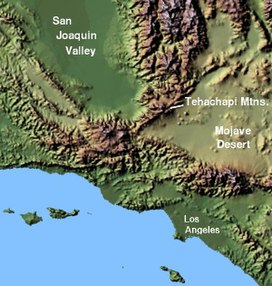
The Tehachapi Mountains (/təˈhætʃəpi/; Kawaiisu: Tihachipia, meaning "hard climb")[1][2] are a mountain range in the Transverse Ranges system of California in the Western United States. The range extends for approximately 40 miles (64 km) in southern Kern County and northwestern Los Angeles County and form part of the boundary between the San Joaquin Valley and the Mojave Desert.
