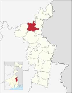
Tehatta II | |
|---|---|
Community development block | |
 | |
| Coordinates: 23°47′00″N 88°27′00″E / 23.7833330°N 88.4500000°E | |
| Country | |
| State | West Bengal |
| District | Nadia |
| Government | |
| • Type | Community development block |
| Area | |
• Total | 172.47 km2 (66.59 sq mi) |
| Elevation | 13 m (43 ft) |
| Population (2011) | |
• Total | 151,231 |
| • Density | 880/km2 (2,300/sq mi) |
| Languages | |
| • Official | Bengali, English |
| Literacy (2011) | |
| • Total literates | 91,926 (68.52%) |
| Time zone | UTC+5:30 (IST) |
| PIN | 741155 (Palashipara) 741156 (Plassey) |
| Telephone/STD code | 03474 |
| Vehicle registration | WB-51,WB-52 |
| Lok Sabha constituency | Krishnanagar |
| Vidhan Sabha constituency | Palashipara |
| Website | nadia |
Tehatta II is a community development block that forms an administrative division in Tehatta subdivision of Nadia district in the Indian state of West Bengal.[1]
- ^ "মহকুমা ও ব্লক | নদীয়া জেলা, পশ্চিমবঙ্গ সরকার | ভারত" (in Bengali). Retrieved 2024-06-01.