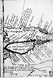

Teiaiagon was an Iroquoian village on the east bank of the Humber River in what is now the York district of Toronto, Ontario, Canada. It was located along the Toronto Carrying-Place Trail. The site is near the current intersection of Jane Street and Annette Street, at which is situated the community of Baby Point.
The name means "It crosses the stream."[1]
- ^ Robinson, Percy J. (2019). Toronto During the French Regime. Toronto: University of Toronto Press. p. 243. ISBN 9781487584504. Retrieved Feb 18, 2022.