| {{{title}}} | |
|---|---|
| European Parliament constituency | |
| Member state | [[{{{memberstate}}}]] |
| This template uses Lua: |
Usage
[edit]| {{{title}}} | |
|---|---|
| European Parliament constituency | |
 Location among the 2014 constituencies | |
| [[File:{{{map}}}|{{{mapsize}}}|alt={{{mapalt}}}|upright=1]] {{{mapcaption}}} | |
| Member state | [[{{{memberstatelink}}}|{{{memberstate}}}]] |
| Electorate | {{{electorate population}}} |
| Created | [[{{{created}}} European Parliament election in {{{memberstatelink2}}}|{{{created}}}]] |
| Dissolved | [[{{{dissolved}}} European Parliament election|{{{dissolved}}} ]] |
| MEPs | {{{meps}}} |
| Recreated | |
| Created | [[{{{created2}}} European Parliament election in {{{memberstatelink2}}}|{{{created2}}}]] |
| Dissolved | [[{{{dissolved2}}} European Parliament election|{{{dissolved2}}} ]] |
| MEPs | {{{meps2}}} |
| Sources | |
| {{{sources}}} | |
{{Infobox European Parliament constituency
| title                 =
| locationmap2014       =
| coordinates           = <!-- {{coord|...|...}} -->
| pushpin_map           =
| pushpin_mapsize       =
| pushpin_mapcaption    =
| map                   =
| mapsize               =
| mapalt                =
| mapcaption            =
| memberstate           =
| memberstatelink       =
| memberstatelink2      =
| electorate population =
| created               =
| dissolved             =
| meps                  =
| created2              =
| dissolved2            =
| meps2                 =
| sources               =
}}
Short syntax
[edit]{{Infobox European Parliament constituency
| title =
| locationmap2014 =
| coordinates = <!-- {{coord|...|...}} -->
| map =
| mapalt =
| mapcaption =
| memberstate =
| electorate population =
| created =
| dissolved =
| meps =
}}
Parameters
[edit]- title
- what appears at the top of the infobox; required
- locationmap2014
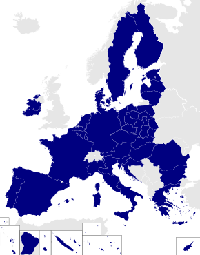
- set to the region code for the constituency if constituency existed in 2014 (must match one of the EP-constituency maps at commons)
- coordinates
- coordinates of constituency using the {{coord}} template; set to decimal longitude if location map set to "yes"
- pushpin_map
- name of a location map to use via {{location map}} (requires coordinates)
| pushpin_mapsize :
- pushpin_mapcaption
- map
- a secondary map
- mapsize
- mapalt
- mapcaption
- memberstate
- the name of the country the constituency is part of
- memberstatelink
- the Wikipedia-article title of the country, if different from its name
- memberstatelink2
- former or full country name, if different from its name, e.g. 'West Germany' or 'the United Kingdom'
- electorate population
- population of electorate as of last election
- created
- date of constituency creation
- dissolved
- date of constituency dissolution
- meps
- number of MEPs
- created2
- dissolved2
- meps2
- sources
- sources for further reading
Examples
[edit]Łódź (existing constituency smaller than member state)
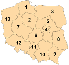
[edit]Łódź is one of 13 constituencies in Poland. The code for its infobox looks like this:
| Łódź | |
|---|---|
| European Parliament constituency | |
 Location among the 2014 constituencies | |
 6th constituency in Poland | |
| Member state | Poland |
| Created | 2004 |
| MEPs | 4 (2004) |
| Sources | |
| [1] | |
{{Infobox European Parliament constituency
| title            = Łódź
| locationmap2014  = PL-6
| coordinates      = {{coord|51.78|19.47}}
| map              = File:European Parliament constituencies Poland.png
| mapcaption       = 6th constituency in [[Poland]]
| created          = 2004
| meps             = 4 (2004)
| memberstate      = Poland
| memberstatelink2 = Poland
| sources          = [http://www.europarl.europa.eu/elections2004/ep-election/sites/en/yourvoice/pl/law.html]
}}
Sweden (existing constituency same size as member state)
[edit]Sweden is a single constituency for European Parliament purposes. The code for its infobox looks like this:
| Sweden | |
|---|---|
| European Parliament constituency | |
| Member state | Sweden |
| Created | 1995 |
| MEPs | 19 (2004) |
| Sources | |
| [2][3] | |
{{Infobox European Parliament constituency
| title              = Sweden
| memberstate        = Sweden
| memberstatelink2   = Sweden
| pushpin_map        = Europe
| pushpin_mapcaption = Location within Europe
| coordinates        = {{coord|67.0|16.0}}
| created            = 1995
| meps               = 19 (2004)
| sources            = [http://www.europarl.europa.eu/election/newep/en/maps.htm][http://www.europarl.europa.eu/elections2004/ep-election/sites/en/yourvoice/index.html]
}}
France (no-longer-existing constituency same size as member state)
[edit]France was a single constituency for European Parliament purposes, but is now subdivided into smaller constituencies. The code for its infobox looks like this:
| France | |
|---|---|
| European Parliament constituency | |
 Shown within European Union | |
| Member state | France |
| Created | 1979 |
| Dissolved | 2004 |
| MEPs | 87 (1999) |
| Sources | |
| [4] | |
{{Infobox European Parliament constituency
| title            = France
| map              = File:EU location FRA.png
| mapcaption       = Shown within [[European Union]]
| created          = 1979
| dissolved        = 2004
| meps             = 87 (1999)
| memberstate      = France
| memberstatelink2 = France
| sources          = [http://www.europarl.europa.eu/election/newep/en/maps.htm]
}}
Leinster (no-longer-existing constituency smaller than member state)
[edit]Leinster was a constituency of the European Parliament until 2004. The code for its infobox looks like this:
| Leinster | |
|---|---|
| European Parliament constituency | |
 Shown within Ireland | |
| Member state | Ireland |
| Created | 1979 |
| Dissolved | 2004 |
| MEPs | 4 (1994–2004), 3 (1979–1994) |
| Sources | |
| [5] | |
{{Infobox European Parliament constituency
| title            = Leinster
| map              = File:IrelandEuroParlLabelled19792004.png
| mapcaption       = Shown within [[Ireland]]
| created          = 1979
| dissolved        = 2004
| meps             = 4 (1994–2004); 3 (1979–1994)
| memberstatelink  = Republic of Ireland
| memberstatelink2 = Ireland
| memberstate      = Ireland
| sources          = [http://www.europarl.europa.eu/election/law/en/lair01en.htm]
}}
Overseas Territories of France (constituency outside the member state)
[edit]The Overseas Territories of France are a constituency of the European Parliament. The code for its infobox looks like this:
| Overseas Territories of France | |
|---|---|
| European Parliament constituency | |
 Shown in blue | |
| Member state | France |
| Created | 2004 |
| MEPs | 3 |
| Sources | |
| [6] | |
{{Infobox European Parliament constituency
| title            = Overseas Territories of France
| map              = File:Outre-mer en.png
| mapcaption       = Shown in [[Overseas departments and territories of France|blue]]
| created          = 2004
| meps             = 3
| memberstate      = France
| memberstatelink2 = France
| sources          = [http://www.europarl.europa.eu/elections2004/ep-election/sites/en/yourvoice/fr/law.html]
}}
Merseyside West (constituency with no map yet)
[edit]Merseyside West was a constituency of the European Parliament, but there is no map yet. The code for its infobox looks like this:
| Merseyside West | |
|---|---|
| European Parliament constituency | |
| Member state | United Kingdom |
| Created | 1984 |
| Dissolved | 1999 |
| MEPs | 1 |
| Sources | |
| [7] | |
{{Infobox European Parliament constituency
| title            = Merseyside West
| map              =
| mapcaption       =
| created          = 1984
| dissolved        = 1999
| meps             = 1
| memberstate      = United Kingdom
| memberstatelink2 = the United Kingdom
| sources          = [http://www.election.demon.co.uk/]
}}
Tracking category
[edit]Microformat
[edit]The HTML mark up produced by this template includes an hCard microformat, which makes the place-name and location parsable by computers, either acting automatically to catalogue article across Wikipedia, or via a browser tool operated by a person, to (for example) add the subject to an address book. For more information about the use of microformats on Wikipedia, please see the microformat project.
If the place or venue has an "established", "founded", "opened" or similar date that is specific to the day, use {{start date}} unless the date is before 1583 CE. If it has a URL, use {{URL}}.
hCard uses HTML classes including:
- adr
- category
- country-name
- extended-address
- fn
- label
- locality
- nickname
- note
- org
- street-address
- url
- vcard
Please do not rename or remove these classes nor collapse nested elements which use them.
