| This is a documentation subpage for Template:Infobox UK place. It may contain usage information, categories and other content that is not part of the original template page. |
| This template is used on approximately 27,000 pages and changes may be widely noticed. Test changes in the template's /sandbox or /testcases subpages, or in your own user subpage. Consider discussing changes on the talk page before implementing them.
Preview message: Transclusion count updated automatically (see documentation). |
| This template adds an automatically generated short description. If the automatic short description is not optimal, replace it by adding {{Short description}} at the top of the article. |
| This template uses Lua: |
| This template uses TemplateStyles: |
| {{{official_name}}} | |
|---|---|
| {{{type}}} | |
| [[File:{{{static_image_name}}}|{{{static_image_width}}} |alt={{{static_image_alt}}}]] {{{static_image_caption}}} | |
| [[File:{{{static_image_2}}}|{{{static_image_2_width}}} |alt={{{static_image_2_alt}}}]] {{{static_image_2_caption}}} | |
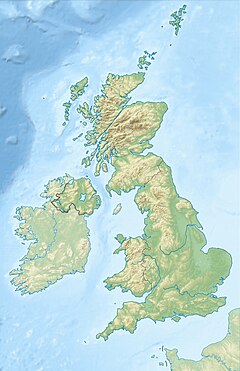
Location within the United Kingdom | |
| Area | 1 sq mi (2.6 km2) {{{area footnotes}}} |
| Population | 0 {{{population_ref}}} |
| • Density | 0/sq mi (0/km2) |
| {{{statistic_title}}} | {{{statistic}}} |
| {{{statistic_title1}}} | {{{statistic1}}} |
| {{{statistic_title2}}} | {{{statistic2}}} |
| Demonym | {{{population_demonym}}} |
| Language | {{{language}}} {{{language1}}} {{{language2}}} |
| OS grid reference | [{{{os Preview warning: Malformed NGR {{{os_grid_reference}}}] |
| Irish grid reference | {{{irish_grid_reference}}} Preview warning: Malformed NGR |
| • Belfast | 0 mi (0.0 km) {{{belfast_direction}}} |
| • Cardiff | 0 mi (0.0 km) {{{cardiff_direction}}} |
| • Douglas | 0 mi (0.0 km) {{{douglas_direction}}} |
| • Dublin | 0 mi (0.0 km) {{{dublin_direction}}} |
| • Edinburgh | 0 mi (0.0 km) {{{edinburgh_direction}}} |
| • London | 0 mi (0.0 km) {{{london_direction}}} |
| • Charing Cross | 0 mi (0.0 km) {{{charingX_direction}}} |
| Civil parish |
|
| Community |
|
| Principal area |
|
| Metropolitan borough |
|
| District |
|
| Unitary authority |
|
| Council area |
|
| District |
|
| Parish | {{{manx_parish}}} |
| Preserved county |
|
| Greater London | |
| Shire county |
|
| Metropolitan county |
|
| Ceremonial county |
|
| Lieutenancy area |
|
| County |
|
| Sheading | {{{manx_sheading}}} |
| Country | {{{country}}} |
| Sovereign state | United Kingdom |
| {{{parts_type}}} | {{{parts}}}
|
| Post town | {{{post_town}}} |
| Postcode district | [[{{{postcode_area}}} postcode area|{{{postcode_district}}}]] |
| Post town | {{{post_town1}}} |
| Postcode district | [[{{{postcode_area1}}} postcode area|{{{postcode_district1}}}]] |
| Post town | {{{post_town2}}} |
| Postcode district | [[{{{postcode_area2}}} postcode area|{{{postcode_district2}}}]] |
| Dialling code | {{{dial_code}}} {{{dial_code1}}} {{{dial_code2}}} |
| Police | |
| Fire | |
| Ambulance | |
| UK Parliament |
|
| Scottish Parliament |
|
| Senedd Cymru – Welsh Parliament |
|
| House of Keys | {{{constituency_manx_parliament}}} |
| NI Assembly |
|
| Councillors | {{{councillors}}} |
| Councillors |
|
| Website | {{{website}}} |
{{Infobox UK place}} is intended for use with articles about places (i.e. human settlements) in the United Kingdom. It has provision for a location map, images, captions, and detailed information about the place e.g. population, governance, and public services.
