This article needs additional citations for verification. (May 2014) |
| Ten Mile Run | |
|---|---|
 Ten Mile Run crossing Canal Road, near its mouth at the Millstone River | |
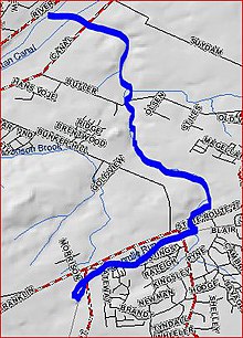
 Map of local area showing Ten Mile Run (highlighted) | |
| Location | |
| Country | United States |
| Physical characteristics | |
| Source | |
| • coordinates | 40°24′39″N 74°35′27″W / 40.41083°N 74.59083°W |
| Mouth | |
• coordinates | 40°27′28″N 74°35′29″W / 40.45778°N 74.59139°W |
• elevation | 39 ft (12 m) |
| Basin features | |
| Progression | Millstone River, Raritan River, Atlantic Ocean |
Ten Mile Run is a tributary of the Millstone River, draining an area in southern South Brunswick and southern Franklin Park, New Jersey in the United States.
Its name is derived from the distance early surveyors estimated it was from the Raritan River on the historic Kings Highway, now Route 27.