| Terkhiin Tsagaan Lake | |
|---|---|
 | |
| Location | Khangai Mountains |
| Coordinates | 48°10′15″N 99°43′20″E / 48.17083°N 99.72222°E |
| Basin countries | Mongolia |
| Max. length | 16 km (9.9 mi) |
| Max. width | 4–10 km (2.5–6.2 mi) |
| Surface area | 61 km2 (24 sq mi) |
| Average depth | 20 m (66 ft) |
| Surface elevation | 2,060 m (6,760 ft) |
| Official name | Terhiyn Tsagaan Nuur |
| Designated | 6 July 1998 |
| Reference no. | 953[1] |
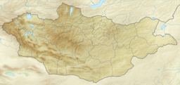
Terkhiin Tsagaan Lake (Mongolian: Тэрхийн Цагаан нуур, romanized: Terkhiin Tsagaan nuur, [tʰirˈçin t͡sʰaˈʁaɴ nʊːr], is a fresh-water lake in the Khangai Mountains in central Mongolia, located in Tariat soum of Arkhangai province. In 670 km to the capital city Ulaanbaatar and 180 km to the center of Tariat soum.
The Khorgo volcano is located near the eastern end of the lake, 10 rivers join this lake and only the Suman River springs from it.[2] The lake is located in Khorgo-Terkhiin Tsagaan Nuur National Park. According to the joint 2022 study of Mongolia's Ministry of Environment and Tourism and World Wide Fund for Nature, the area of the lake decreased by 6.4% from 7950.0 ha in 1995 to 7440.1 ha in 2015. This resulted in reduction of wetlands areas by 23.5% and increase by 39.4% of sands and eroded lands surrounding the lake.[3]
- ^ "Terhiyn Tsagaan Nuur". Ramsar Sites Information Service. Retrieved 25 April 2018.
- ^ "Terkhiin Tsagaan Nuur in Tariat". Lonely Planet. Retrieved 2017-03-02.
- ^ "Terkhiin tsagaan natural park". mongolia-trips. Mongolia Trips. Retrieved 25 November 2023.
