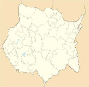
Tetecala | |
|---|---|
City and Municipality | |
| Tetecala de la Reforma | |
 | |
| Coordinates: 18°43′N 99°23′W / 18.717°N 99.383°W | |
| Country | |
| State | Morelos |
| Founded | 1583[2] |
| City | December 11, 1873 |
| Municipal seat | May 17, 1930 |
| Area | |
| • Municipality | 53.26 km2 (20.56 sq mi) |
| Elevation (of seat) | 994 m (3,261 ft) |
| Population (2010) Municipality | |
| • Municipality | 6,473[1] |
| Time zone | UTC−6 (CST) |
| • Summer (DST) | UTC−5 (CDT) |
| Postal code (of seat) | 62620 |
| Area code | 751 |
| Website | Official site (in Spanish) |
Tetecala is a city in the Mexican state of Morelos.
The city serves as the municipal seat for the surrounding municipality, with which it shares a name. The toponym Tetecala comes from a Nahuatl name and means "place of stone houses".[3] The full name of the town is Tetecala de la Reforma because the Laws of the Reforma were signed there in the mid-19th century.[4]
The municipality reported 7,772 inhabitants in the 2015 census.[5]
- ^ Giovannelli, Nuestro Mexico-Claudio. "Tetecala". Nuestro Mexico (in Spanish). Retrieved May 9, 2020.
- ^ "Tetecala". Tetecala | MORELOS (in Spanish). 3 June 2013. Retrieved May 9, 2020.
- ^ http://siglo.inafed.gob.mx/enciclopedia/EMM17morelos/municipios/17021a.html (Dec 17, 2018)
- ^ "Tetecala" [Tetecala] (in Spanish). Guia Turistica Mexico. Retrieved Jan 21, 2019.
- ^ http://cuentame.inegi.org.mx/monografias/informacion/mor/poblacion/ (Dec 13, 2018)

