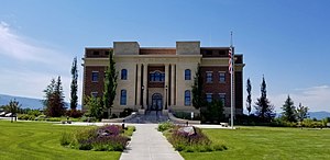
Teton County | |
|---|---|
 | |
 Location within the U.S. state of Idaho | |
 Idaho's location within the U.S. | |
| Coordinates: 43°45′N 111°13′W / 43.75°N 111.21°W | |
| Country | |
| State | |
| Founded | January 26, 1915 |
| Named for | The Teton Mountains |
| Seat | Driggs |
| Largest city | Victor |
| Area | |
| • Total | 451 sq mi (1,170 km2) |
| • Land | 449 sq mi (1,160 km2) |
| • Water | 1.1 sq mi (3 km2) 0.2% |
| Population (2020) | |
| • Total | 11,630 |
| • Density | 26/sq mi (10/km2) |
| Time zone | UTC−7 (Mountain) |
| • Summer (DST) | UTC−6 (MDT) |
| Congressional district | 2nd |
| Website | tetoncountyidaho |
Teton County is a county located in the U.S. state of Idaho. As of the 2020 census, the population was 11,630.[1] The county seat is Driggs,[2] and the largest city is Victor. The county was established in 1915 and was named after the Teton Mountains to the east.[3]
Teton County is part of the Jackson, WY-ID Micropolitan Statistical Area.
The Teton Valley was discovered by John Colter in 1808, a member of the Lewis and Clark Expedition (1804–06). It became known as Pierre's Hole, and it hosted the well-attended 1832 Rendezvous, which was followed by the Battle of Pierre's Hole.
- ^ Cite error: The named reference
2020 Censuswas invoked but never defined (see the help page). - ^ "Find a County". National Association of Counties. Retrieved June 7, 2011.
- ^ "Teton County". State of Idaho. Archived from the original on August 15, 2009. Retrieved May 29, 2009.