Teusaquillo | |
|---|---|
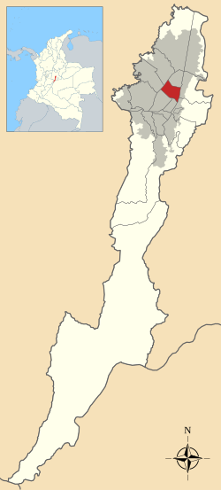
 Location of the locality in the city of Bogotá | |
 Location of the locality in the Capital District of Bogotá | |
| Coordinates: 4°40′14″N 74°05′35″W / 4.67056°N 74.09306°W | |
| Country | |
| City | Bogotá D.C. |
| Neighbourhoods | |
| Area | |
| • Total | 14.19 km2 (5.48 sq mi) |
| Elevation | 2,600 m (8,500 ft) |
| Population (2007)[1] | |
| • Total | 139,298 |
| • Density | 9,800/km2 (25,000/sq mi) |
| Time zone | UTC-5 (Colombia Standard Time) |
| Website | Official website |
Teusaquillo is the 13th locality of Bogotá, capital of Colombia. It is located in the geographic center of the city, to the northwest of downtown Bogotá. This district is inhabited by middle and upper class residents. It is an urbanized locality with several green zones as parks, avenues, and the campus of the National University of Colombia. Most of the heritage buildings and houses of Bogotá are in this locality. It is located on the former site of an indigenous resguardo known as Pueblo Viejo (Old Village), which existed until the main urbanization phase of the 20th century.
- ^ (in Spanish) Population 2007 - DANE