This article needs additional citations for verification. (July 2017) |
Texarkana, Arkansas | |
|---|---|
From top, left to right: Downtown, Augustus M. Garrison House, Texarkana City Hall, Texarkana state line | |
| Nickname(s): The Arkansas Side, TXK | |
| Motto: "Twice as Nice" | |
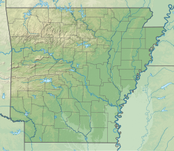
 Location in Miller County, Arkansas | |
| Coordinates: 33°28′12″N 94°00′30″W / 33.47000°N 94.00833°W | |
| Country | United States |
| State | Arkansas |
| County | Miller |
| Incorporated | August 10, 1880 |
| Government | |
| • Type | Council-Manager |
| Area | |
• Total | 42.21 sq mi (109.31 km2) |
| • Land | 41.98 sq mi (108.72 km2) |
| • Water | 0.23 sq mi (0.59 km2) |
| Elevation | 358 ft (109 m) |
| Population | |
• Total | 29,387 |
| • Density | 700.06/sq mi (270.30/km2) |
| Time zone | UTC−6 (Central (CST)) |
| • Summer (DST) | UTC−5 (CDT) |
| ZIP code | 71854 |
| Area code | 870 |
| FIPS code | 05-68810 |
| GNIS feature ID | 2405580[2] |
| Website | cityoftexarkanaar |
Texarkana is a city in the U.S. state of Arkansas and the county seat of Miller County, on the southwest border of the state. As of the 2020 census, it had a population of 29,387.[3] It is the twin city of Texarkana, Texas, located just across the state line. The city was founded at a railroad intersection on December 8, 1873, and was incorporated in Arkansas on August 10, 1880. Texarkana and its Texas counterpart are the principal cities of the Texarkana metropolitan area, which in 2021 was ranked 289th in the United States with a population of 147,174, according to the United States Census Bureau.
Within the Ark-La-Tex subregion of southwest Arkansas, Texarkana is located in the Piney Woods, an oak–hickory forest that dominates the flat Gulf Coastal Plain. Texarkana's economy is based on agriculture. The city has long been a trading center, first located at the intersection of major railroads serving Texas, Arkansas and north into Missouri. Since then three major Interstate highways constructed crossroads here: Interstate 30 (I-30), I-49, and the future I-69. The Red River Army Depot is the largest single employer in the city.
The Texarkana Arkansas School District is the largest public school district on the Arkansas side. The city has a branch campus of the University of Arkansas Hope-Texarkana (UAHT). On the Texas side is located Texarkana College.
- ^ "2021 U.S. Gazetteer Files: Arkansas". United States Census Bureau. Retrieved May 31, 2022.
- ^ a b U.S. Geological Survey Geographic Names Information System: Texarkana, Arkansas
- ^ a b "P1. Race – Texarkana city, Arkansas: 2020 DEC Redistricting Data (PL 94-171)". U.S. Census Bureau. Retrieved May 31, 2022.


