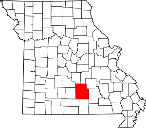
Texas County | |
|---|---|
 Texas County Administrative Center | |
 Location within the U.S. state of Missouri | |
 Missouri's location within the U.S. | |
| Coordinates: 37°19′N 91°58′W / 37.32°N 91.96°W | |
| Country | |
| State | |
| Founded | February 14, 1845[1] |
| Named for | Republic of Texas |
| Seat | Houston |
| Largest city | Licking |
| Area | |
• Total | 1,179 sq mi (3,050 km2) |
| • Land | 1,177 sq mi (3,050 km2) |
| • Water | 2.0 sq mi (5 km2) 0.2% |
| Population (2020) | |
• Total | 24,487 |
| • Density | 21/sq mi (8.0/km2) |
| Time zone | UTC−6 (Central) |
| • Summer (DST) | UTC−5 (CDT) |
| Congressional district | 8th |
| Website | www |
Texas County is a county located in the southern portion of the U.S. state of Missouri. As of the 2020 census, the population was 24,487.[2] Its county seat is Houston.[3] The county was organized in 1843 as Ashley County. Its name was changed in 1845 to Texas County, after the Republic of Texas. The 2010 U.S. Census indicates that the county was the center of population for the United States.[4]

- ^ Cite error: The named reference
Eatonwas invoked but never defined (see the help page). - ^ "Explore Census Data". data.census.gov. Retrieved December 24, 2021.
- ^ "Find a County". National Association of Counties. Retrieved June 7, 2011.
- ^ "Mean Center of Population for the United States: 1790 to 2010" (PDF). United States Census Bureau. Archived from the original (PDF) on May 21, 2013. Retrieved March 28, 2014.