Thap Sakae
ทับสะแก | |
|---|---|
 Huai Yang, Thap Sakae, view toward the Myanmar border | |
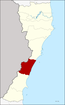
 District location in Prachuap Khiri Khan province | |
| Coordinates: 11°30′0″N 99°37′18″E / 11.50000°N 99.62167°E | |
| Country | Thailand |
| Province | Prachuap Khiri Khan |
| Area | |
| • Total | 538.0 km2 (207.7 sq mi) |
| Population (2008) | |
| • Total | 47,645 |
| • Density | 88.31/km2 (228.7/sq mi) |
| Time zone | UTC+7 (ICT) |
| Postal code | 77130 |
| Geocode | 7703 |
Thap Sakae (Thai: ทับสะแก, pronounced [tʰáp sākɛ̄ː]) is a district (amphoe) in the southern part of Prachuap Khiri Khan province, central Thailand.